










Indonesia has experienced decades of hard-earned progress in disaster governance, risk information, early warning and operational response. The next national capability challenge is different: how to convert that institutional strength into a faster and more resilient field execution chain across thousands of islands, multiple levels of government and sharply different operating environments.
The scale of the task is visible in BNPB’s official 2025 compilation, released in July 2026. It records 4,727 disaster events, including 2,009 floods, 1,329 forest and land fires, 958 extreme-weather events and 330 landslides. Those four categories represented 97.9% of all recorded events. The same compilation lists more than 10.95 million people affected and more than 1.15 million displaced or evacuated. These are not abstract statistics. They describe a national operating tempo in which frequent hydrometeorological emergencies coexist with lower-frequency but potentially catastrophic earthquakes, tsunamis and volcanic eruptions.
This creates two response rhythms. The first demands daily readiness, distributed assets and rapid local action. The second demands surge capacity, national reinforcement and continuity through the first 72 hours. A single-purpose procurement program cannot solve both. A national capability architecture can.
The gap is not warning alone – it is warning-to-action
Indonesia is strengthening the upstream side of disaster management. BMKG reported in October 2025 that earthquake-tsunami warnings had been reduced from five minutes to a maximum of three minutes, with higher accuracy and broader coverage through the IDRIP program. The Multi-Hazard Early Warning System connects national monitoring and dissemination, while BNPB and regional Pusdalops carry warnings into emergency-management workflows.
The value of a warning, however, is ultimately determined downstream. It must become a verified incident, a named owner, a task, a route, a safe deployment, a logistics plan and a closed feedback loop. If field teams cannot reach the location, lose connectivity, operate from different maps or cannot see who has completed which task, the national information advantage is diluted at the point of action.
BNPB’s 2025-2029 Strategic Plan is explicit about this institutional challenge. It identifies very low integration and interoperability among BNPB applications as a strategic issue, while also setting out investment in regional Pusdalops facilities, operator capacity, early-warning dissemination, logistics and equipment. The practical opportunity is therefore not to replace national platforms. It is to add a resilient field layer beneath them.
Six national operational gaps to close
| Operational gap | What it looks like during an incident | Capability response |
| Warning-to-tasking latency | An alert is received, but ownership, priority and field confirmation are delayed | Standard incident data, task assignment, acknowledgements and escalation rules |
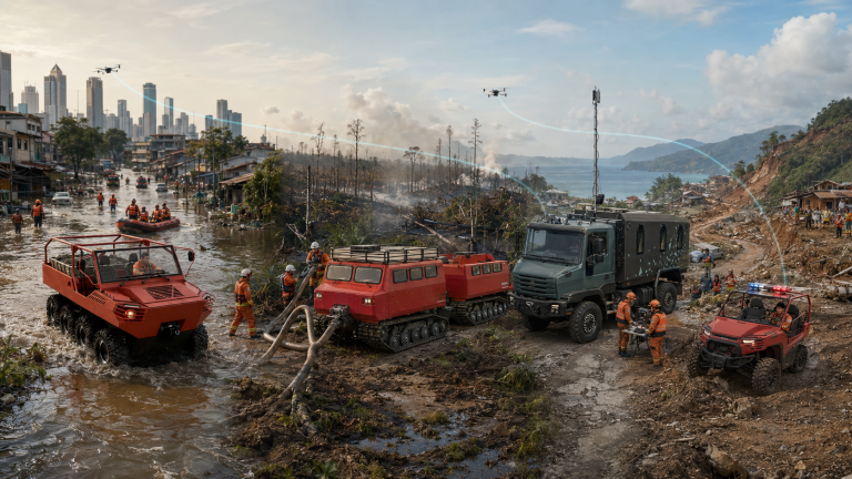
| Terrain and last-mile access | Floodwater, peat, mud, rubble, steep ground or damaged roads stop conventional vehicles | A portfolio of wheeled, tracked, amphibious, compact and unmanned mobility classes |
| Fragmented field picture | Agencies see different maps, positions, video feeds and task status | One permission-controlled common operational picture for the incident |
| Power, network and command-link disruption | Public connectivity or grid power fails, or contact with higher command is interrupted | Edge computing, local power, mesh networking and authorized offline continuity |
| Equipment without readiness | Assets exist but training, maintenance, spares or acceptance criteria are inconsistent | Capability packages with doctrine, exercises, maintenance and lifecycle accountability |
| Cross-agency friction | Data and equipment cannot interoperate quickly across institutions or regions | Open interfaces, shared minimum data and a jointly governed reference architecture |
These gaps are connected. A responder cannot act on an excellent map if there is no route. A tracked vehicle cannot create national value if its status is invisible to the incident command post. A robot does not reduce risk if video, gas data and evacuation triggers sit in separate systems. System design must connect the entire chain.
Any Terrain. Any Mission. One System. Powered by SAE.
For Jinjia Special Equipment Technology, this phrase is an architecture rather than a slogan.
- Any Terrain means selecting the correct mobility class for water, soft peat, mud, debris, mountains, narrow urban access or damaged roads.
- Any Mission means configuring command, communications, rescue, medical, firefighting, reconnaissance, energy and logistics modules around the operational requirement.
- One System means that responders, vehicles, robots, sensors, data, procedures and training use one coherent operating model.
- Powered by SAE means that a situational-awareness and edge-coordination layer keeps the field picture, task flow and asset status usable in connected, degraded and disconnected conditions.
The system is deliberately modular. Indonesia should not have to buy a different closed vehicle architecture for every hazard. It can instead standardize power, data, mounting, safety and training interfaces, then select regional platform and module combinations based on the local risk profile.
A four-layer national architecture
| Layer | National role | Design principle |
| National data and command | BNPB systems, DIBI, InaRISK, BMKG MHEWS and other authoritative platforms provide trusted risk, warning and incident information | These platforms remain the systems of record |
| Regional operations | BNPB, BPBD/Pusdalops, Basarnas, fire services, forestry agencies and supporting institutions coordinate according to Indonesian authority and SOPs | Governance and command remain Indonesian-owned |
| SAE field edge | Local common picture, edge computing, tasking, offline maps, resilient radio/mesh/satellite/private-network options and synchronization | Bring selected authoritative data to the field and return operational status through approved interfaces |
| Frontline assets | Responders, all-terrain vehicles, UAVs, UGVs, firefighting robots, pumps, sensors, power, medical and logistics modules | Every asset is visible, accountable and linked to a task |
This positioning matters. SAE should not duplicate InaRISK, become a new national database or compete with BMKG as a warning authority. Its purpose is operational: use selected official data, combine it with live field status and help authorized teams coordinate execution. When external links return, the local incident record can synchronize back through Pusdalops-compatible interfaces.
Resilience through the “three interruptions”
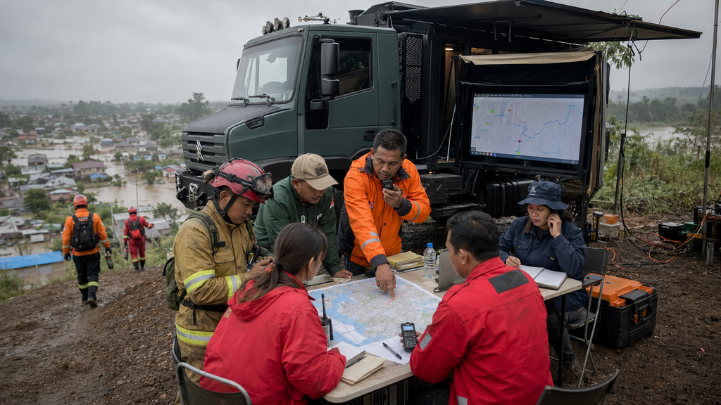
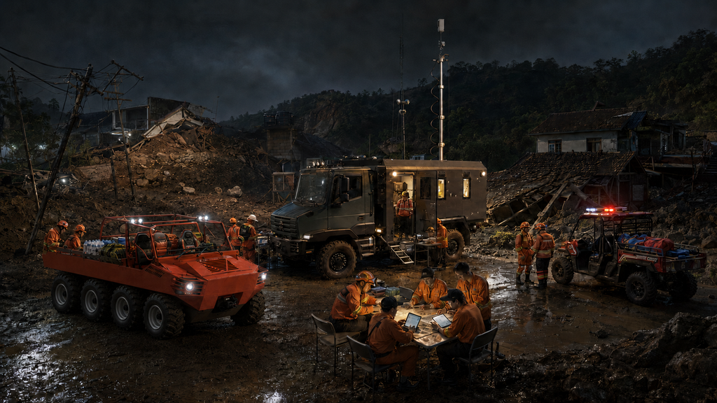
Major disasters often produce three simultaneous interruptions: public connectivity is unavailable, grid power is disrupted, and the link to a higher command center is lost. The phrase “No Power / No Network / No Command” does not mean operating without leadership. It means the field must retain an authorized, distributed command capability when external services or higher-level communications are temporarily unavailable.In that condition, an SAE-equipped response cell can maintain offline maps, team and vehicle positions, priority tasks, local video and sensor feeds, evacuation triggers and an incident log. Mesh nodes can relay essential traffic locally; a vehicle or portable edge node can provide processing and communications; mobile power can sustain critical loads. The operating model continues under pre-agreed SOPs and reconnects to the higher system when links are restored.
One portfolio, not one vehicle
Indonesia’s terrain makes platform diversity a necessity. The national standard should define interoperable mobility classes rather than prescribe an identical fleet everywhere.
| Mobility class | Representative Jinjia assets | Appropriate role |
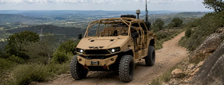
| Light and compact | Electric off-road motorcycles/ATVs, fire-rescue UTVs and compact 4×4 mobility | Rapid reconnaissance, narrow access, medical and light logistics tasks |
| Compact unmanned | Delta 150 compact 4×4 electric UGV, tracked carriers and firefighting robots | Hazard-zone inspection, payload delivery and remote operations |
| High-mobility wheeled | F120 4×4 high-mobility truck | Personnel, command, communications, modules and logistics on degraded roads |
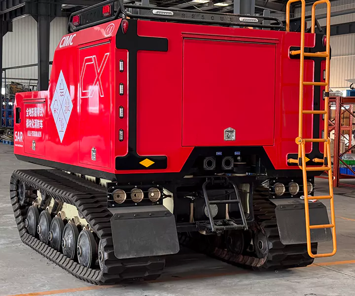
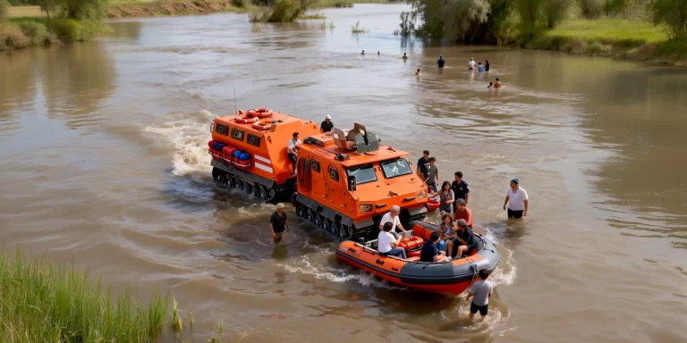
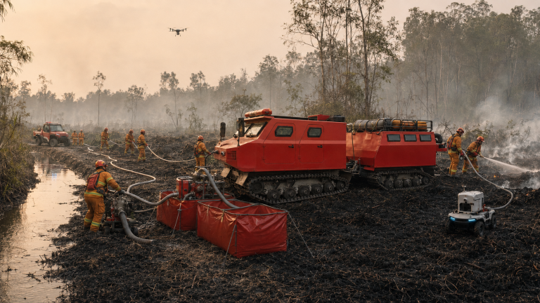
| Amphibious and tracked | 8×8 amphibious utility platform and BN117 tracked family | Floodwater, wetlands, soft peat, swamp, heavy modules and routes beyond conventional access |
Mission modules turn these carriers into operational capabilities: SAE command and communications; evacuation and medical support; pumps, hose, water or agent delivery; field energy and lighting; UAV/UGV reconnaissance; and sustainment logistics. A province can choose the mix it needs while preserving a common data and training model.
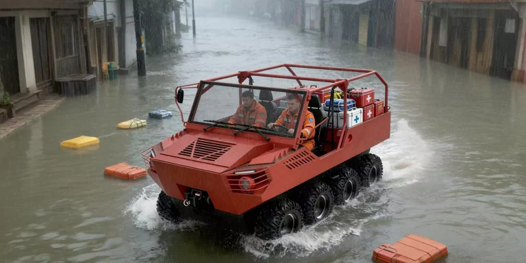
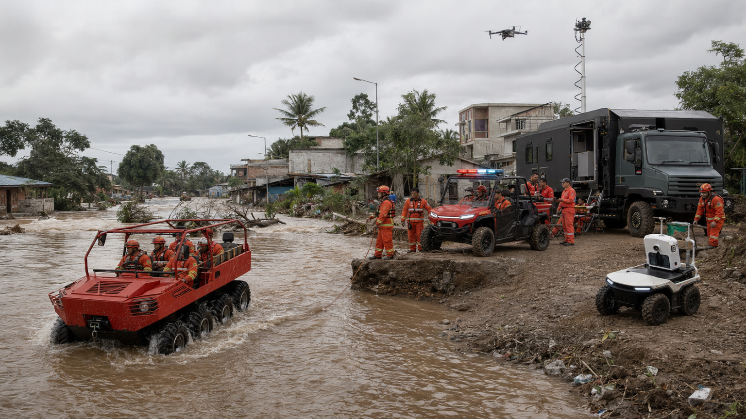
The 8×8 illustrates the principle. In a flood package it should not be described as a small fire truck. It functions as an amphibious rescue carrier, mobile-energy source, communications and SAE node, and a platform for evacuation or mission modules. The BN117 family can bring pumps, water, personnel or command capability into soft terrain. UTVs, motorcycles and unmanned systems continue the chain into narrower or more hazardous areas.
Four scenarios, one operating spine
Flood and urban inundation
An authoritative warning enters Pusdalops. The field cell verifies routes and assigns sectors. Amphibious and high-mobility platforms open access; compact assets work from the dry edge and along narrow streets. SAE maintains shelter, route, team and vehicle status. During the first 72 hours, the same cell supports evacuation, pumps, field power, medical/cold-chain loads and relief distribution.
Earthquake, tsunami, volcano and landslide
The priority is rapid establishment of a local resilience cell: an edge node, resilient communications, field energy, reconnaissance, medical support, water and logistics. High-mobility vehicles carry the cell over damaged roads; compact and unmanned assets move beyond the roadhead. The incident commander gains a local picture even before national connectivity is fully restored.
Peatland and forest fire
SAE can track teams, water sources or wells, pump and hose routes, thermal observations, task status and evacuation triggers. BN117 or other low-ground-pressure platforms carry pumps, water or modules into soft terrain; UTVs and UGVs support flank, reconnaissance and high-exposure work. This ground system complements satellite, UAV and air operations by making the final kilometre observable and sustainable.
Urban and industrial fire
Firefighting robots and UGVs create distance from heat, smoke, collapse and hazardous materials. SAE brings together team position, video, thermal or gas feeds, robot status and evacuation triggers. The objective is not automation for its own sake. It is to reduce responder exposure while strengthening incident command.
National ownership and lifecycle readiness
A national system cannot be built as a vendor-controlled island. The program should require:
- Indonesian data governance, hosting and access controls appropriate to each agency;
- Bahasa Indonesia user interfaces and locally validated workflows;
- open, documented interfaces for approved radios, sensors, UAVs, UGVs and existing assets;
- Indonesian integration, maintenance, spare-parts and training capacity;
- common acceptance tests for mobility, communications, interoperability and field endurance;
- doctrine, tabletop exercises, field exercises and after-action improvement as part of every package.
This changes the unit of procurement. The object is no longer a vehicle or a software licence. It is operational readiness: trained people, serviceable equipment, usable data, rehearsed procedures and measurable performance over the lifecycle.
A practical next step with BNPB
The immediate proposal is intentionally modest and evidence-based.
- Hold a technical architecture session with BNPB and relevant operational institutions to confirm governance, interfaces and priority scenarios.
- Conduct one joint tabletop and field demonstration using Indonesian workflows and existing systems.
- Select one reference pilot, establish baseline KPIs and agree a jointly governed validation plan.
No credible partner should promise an arbitrary improvement percentage before measuring the current process. The pilot should baseline warning-to-tasking time, field-network activation, access beyond the roadhead, responder accountability, task completion, equipment availability and after-action data completeness. Targets can then be set with Indonesian operators.
At ADEXCO 2026, the most valuable conversation is therefore not “Which vehicle should Indonesia buy?” It is “What national operating architecture will allow every warning, responder and asset to work as one capability?”Any Terrain. Any Mission. One System. Powered by SAE.
Explore JINJIA solutions
Situational Awareness System: https://responsemobility.com/situational-awareness-system/
Emergency Response Solutions: https://responsemobility.com/solutions/
Amphibious Utility Vehicle: https://responsemobility.com/amphibious-utility-vehicle/
Contact Jinjia: https://responsemobility.com/contact/
Sources
- BNPB – Kompilasi Data Kejadian dan Dampak Bencana 2025 – official dataset published July 2026; statistics in this article were calculated from its national recap workbook.
- BNPB Regulation No. 5/2025 – Strategic Plan 2025-2029 – strategic issues, Pusdalops, early warning, logistics and equipment priorities.
- BNPB – Vision and Mission – national mission for fast, effective emergency handling and logistics/equipment governance.
- BMKG – IDRIP closing and earthquake-tsunami early warning modernization – warning time, MHEWS and downstream dissemination chain.
- ADEXCO 2026 – Official Event Information – 9-12 September 2026, Jakarta International Expo.
- Jinjia – Situational Awareness System and Jinjia – System Overview – SAE positioning and equipment-system concept.